geographical annotations to
Ainsworth, William, 'Notes on a journey from Kaïsaríyah, by Malátíyah, to Bir or Birehjik, in May and June, 1839'
19th century sources
website of Jelle Verheij, historian
home | publications | pictures | historical pictures | travel snap shots | monuments | 19th century sources | research tools | links | contact
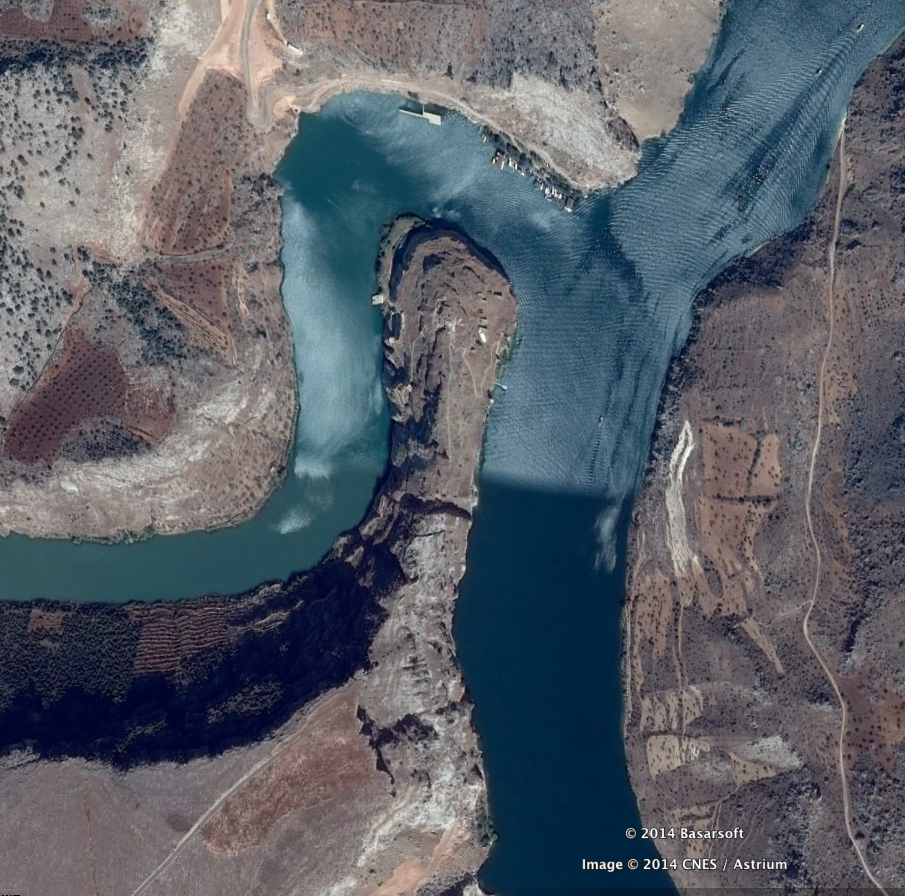
Satellite view of Rumkale (Google Earth) (click on the image to expand)
Samosata → Şamşat. This place was flooded by the Atatürk Dam Lake; the name was transferred to a new settlement nearby, presently the centre of Şamşat district of Adıyaman province
I'z O'ghlú → İzolu, Kuşsarayı (village in Baskil district, Elazığ province, on the Euphrates, east of Malatya
Shiró → Doğanyol (centre of Doğanyol district, Malatya province)